The Geospatial and Big Data Sciences Cluster is dedicated to providing critical spatial inputs that enhance understanding, planning, and prioritizing agricultural research. Our cluster integrates multiple disciplines of agriculture and leverages geospatial information and big data analytics to address various agricultural challenges.
The Cluster plays a vital role in supporting research programs by generating geospatial information using Remote Sensing (RS), Global Positioning System (GPS), and Geographic Information System (GIS) technologies. Our focus extends from crop distribution and yield estimation to identifying stresses and addressing issues related to water use, productivity enhancement, soil health management, agrobiodiversity conservation, and climate variability. We utilize big data analytics to extract valuable insights from our extensive long-term datasets, which are generated from experiments and trials.
Focus Areas:
Within our cluster, we emphasize several focus areas to advance agricultural knowledge and enhance decision-making:
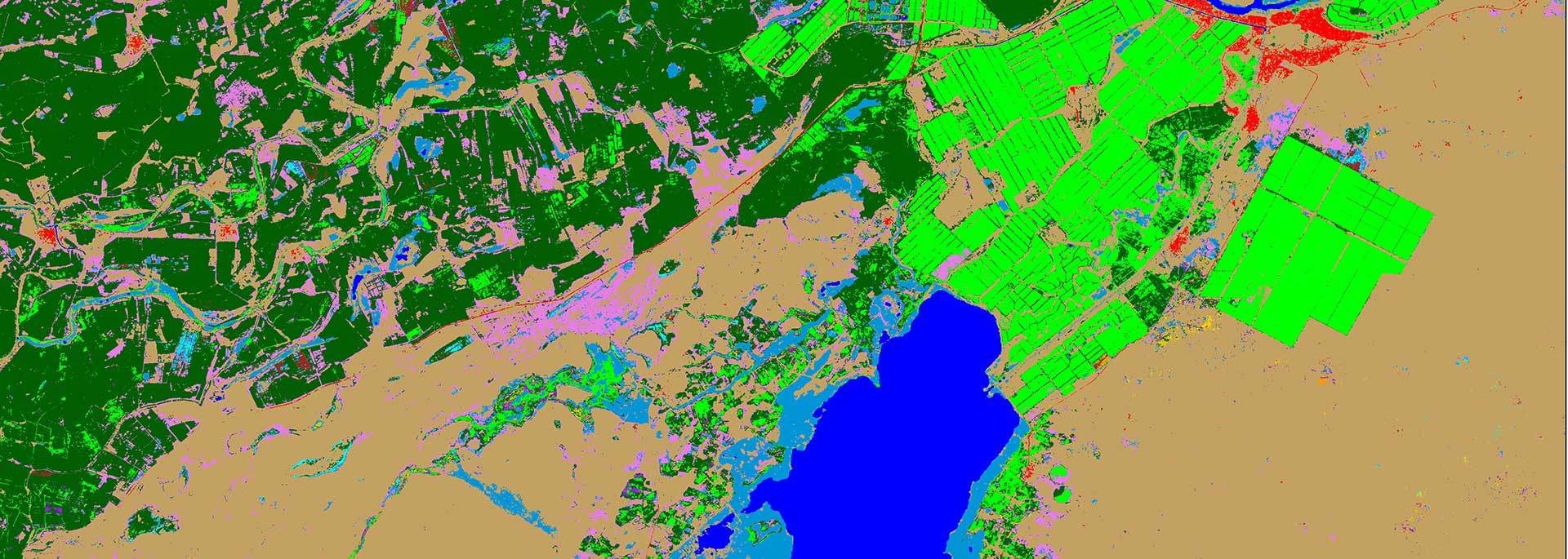
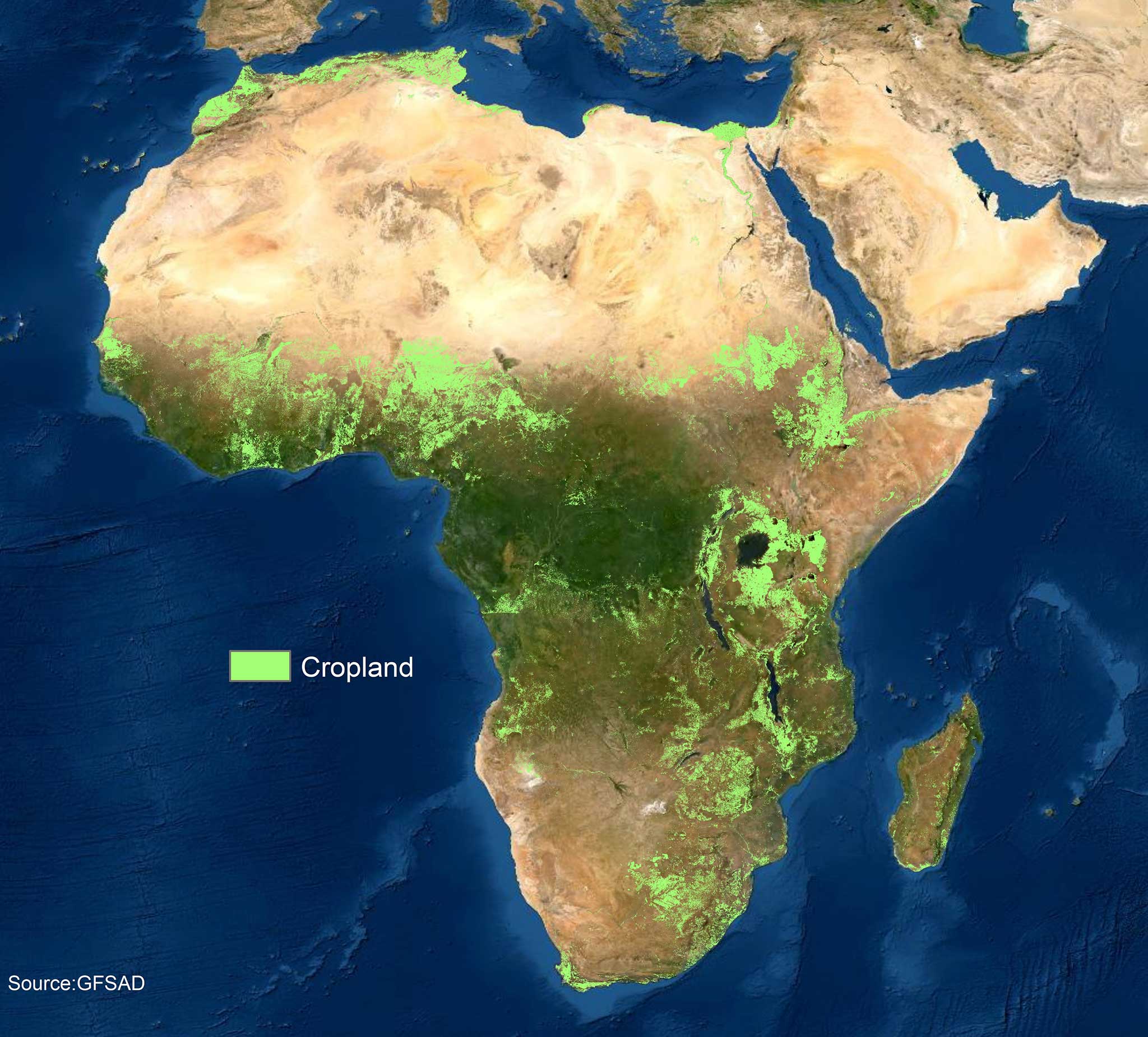
Crop and LULC mapping: We are experts in mapping crop type, croplands, cropping patterns, crop intensity and Land Use and Land Cover (LULC) utilising satellite imagery, ground data and machine learning algorithms.
Crop stress and biophysical parameter analysis: We employ hyperspectral image analysis and spectral matching techniques to extract information on crop stresses and biophysical parameters, aiding in early detection and mitigation.
Crop yield prediction: Leveraging diverse data sources, such as satellite imagery and ground sensors, we develop models and techniques for accurate crop yield prediction at the field level. Integrating crop modelling with remote sensing to estimate yield at various administrative levels.
Spectral variability analysis: Through machine learning algorithms, we gain insights into spectral variability due to crop traits, supporting trait selection and crop management decisions.
Proximal and remote sensing integration: We leverage Internet of Things (IoT)-based platforms and high-resolution remote sensing imagery to link proximal and remote sensing for field phenotyping.
Acquisition of high-resolution imagery: Using industry-standard unmanned aerial vehicles (UAVs) equipped with well-calibrated sensors, we acquire very high spatial and temporal resolution imagery for precise monitoring and analysis.
Trait characteristics of crop varieties: We utilize spectral libraries, genetic meta-information, and breeding trials to characterize the traits of crop varieties, facilitating targeted breeding efforts.
Typology of crop production environments: We identify factors contributing to yield gaps and address them by understanding the typology of crop production environments.
Pest and disease hotspots: Through geospatial analysis, we identify hotspots and endemic areas prone to pests and diseases, enabling targeted management strategies.
Hyperspectral data repository We maintain a repository of hyperspectral point data and imagery, including spectral libraries of screened germplasm collections at ICRISAT genebank.
Spatial and Non-spatial data: We handle spatial data involving geographic or geometric attributes, often managed with Geographic Information Systems (GIS) and Non-spatial data, typically tabular, involves statistical analysis, machine learning, and data visualization techniques. Further integrating non-spatial data with spatial for better analysis.