We (Digital Agriculture and Geospatial Sciences Theme) are building smarter, more resilient agricultural systems by combining geospatial intelligence and digital technologies. This theme operates at the intersection of space, data, and on-the-ground impact, empowering farmers, researchers, and policymakers with the insights they need to act.
To structure our work, we focus on two sub-themes:
Geospatial Sciences
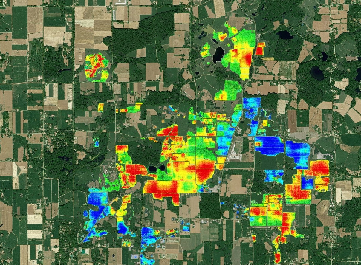
Geospatial Sciences give us the “where”, the spatial dimension that makes agricultural decisions more targeted and effective. This sub-theme uses remote sensing, GIS, and spatial analytics to monitor crops, assess land use, detect risks, and understand agro-ecological patterns.
Remote Sensing and GIS: We map crops, track stress, estimate yields, and generate spatial intelligence to guide research and policy.
Crop Mapping and Yield Estimation: Using satellite imagery, field data, and ML to monitor cropping patterns, land use, and productivity at various scales.
Crop Suitability Mapping: Using biophysical, social, economic and environmental to identify the suitable areas.
Crop Stress Detection and Biophysical Monitoring: We use multi& hyperspectral imaging and spectral indices like NDVI to detect drought, nutrient deficiency, and pest pressure.
Pest and Disease Risk Mapping: Geospatial risk layers help identify pest hotspots and design early response strategies.
Typology and Production Environment Analysis: We analyze agro-ecological zones to understand how environment, practices, and policy interact to affect gaps.
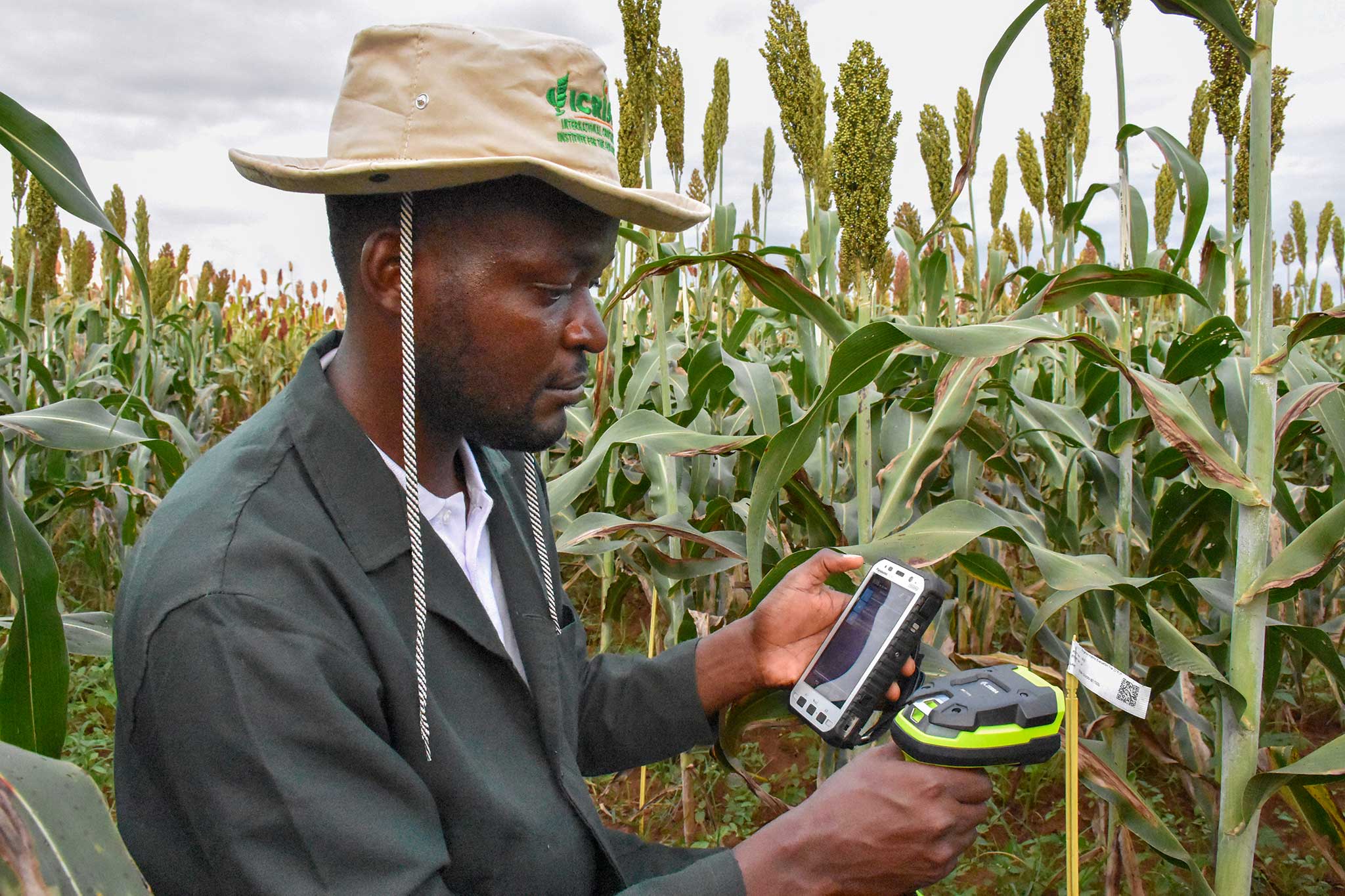
Proximal and Remote Sensing Integration: We connect field sensor data with UAV and satellite imagery to enable precision phenotyping and targeted interventions.
Digital Innovations
Digital Agriculture gives us the “how”, turning insights into action. This sub-theme focuses on digital tools, AI systems, and data platforms that enable real-time, evidence-based decisions for farmers and development actors alike.Digital Agriculture gives us the “how”, turning insights into action. This sub-theme focuses on digital tools, AI systems, and data platforms that enable real-time, evidence-based decisions for farmers and development actors alike.
Digital Tools and ICT Platforms: We design real-time crop monitoring, advisory, and precision farming systems built for local relevance and usability.
Big Data Analytics: We mine large datasets from field trials, satellite archives, and climate records to generate forecasting, risk assessment, and insights.
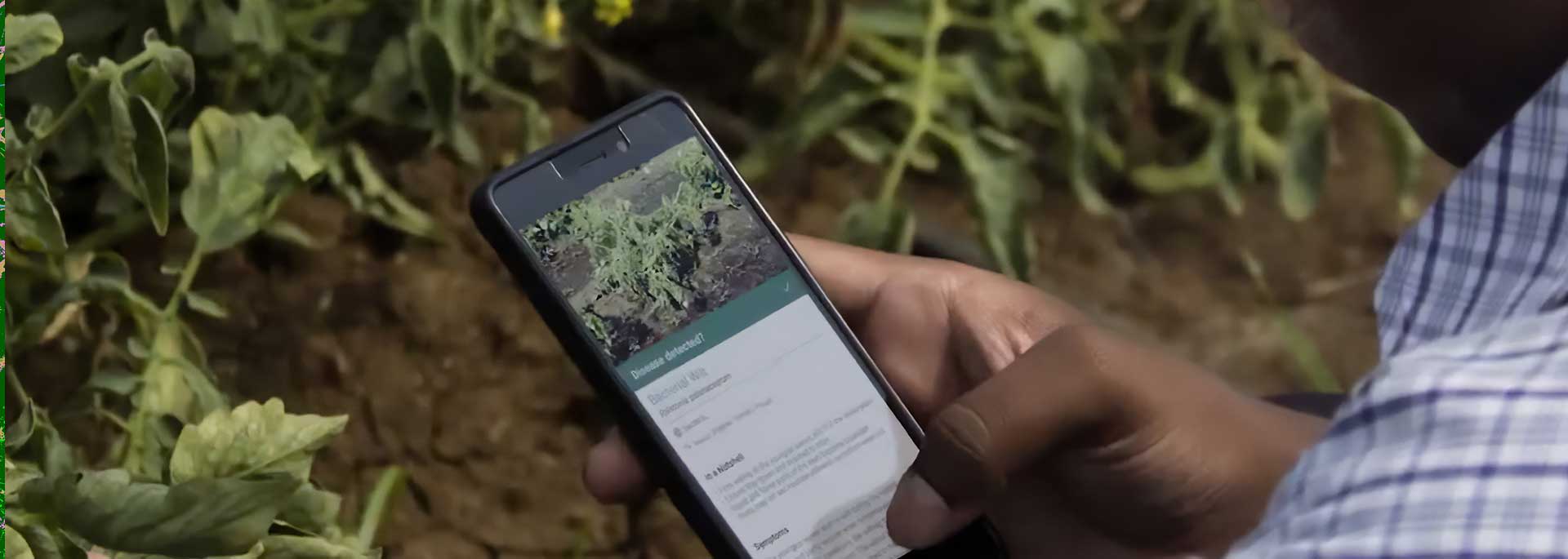
AI and Machine Learning Models: Our models help with yield prediction, disease detection, and adaptive farming strategies at multiple scales.
AI-Enabled Agriculture: We are advancing AI models that detect hotspots and optimize interventions in time-critical scenarios.
Agri-LLM Development: We build large language models specific to agriculture using ICRISAT’s Open Access Repository, powered by Retrieval-Augmented Generation frameworks.
Generative AI for Advisory: Conversational AI agents delivers localized, science-based, farmer-friendly advisories.
Digital Monitoring, Reporting, and Verification Systems (MRV): Our MRV systems combine imagery and on-ground validation to track regenerative practices and enable carbon credit verification at scale.
Digital MELIA Platforms: We design systems for Monitoring, Evaluation, Learning, Impact, and Adaptation that track project performance in real time.
Knowledge Sharing and Innovation Ecosystems: We support open data platforms, incubate innovations, and mentor ag-tech startups.